Granite Creek Preservation Society

Welcome to The GCPS ARCHIVE. This is your gateway to the biggest on-line repository of historical documents, pictures, and general information relating to the history of Granite Creek British Columbia.
Department of Mines Geological Survey 1911. (pdf)
Tulameen section map. Trails, mines, more
[00]
The oldest map we have.
Old Granite Creek Townsite Map
[40]
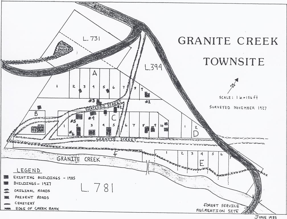
1985 map of Granite Creek.
Granite Creek Townsite Map - 1985
[41]
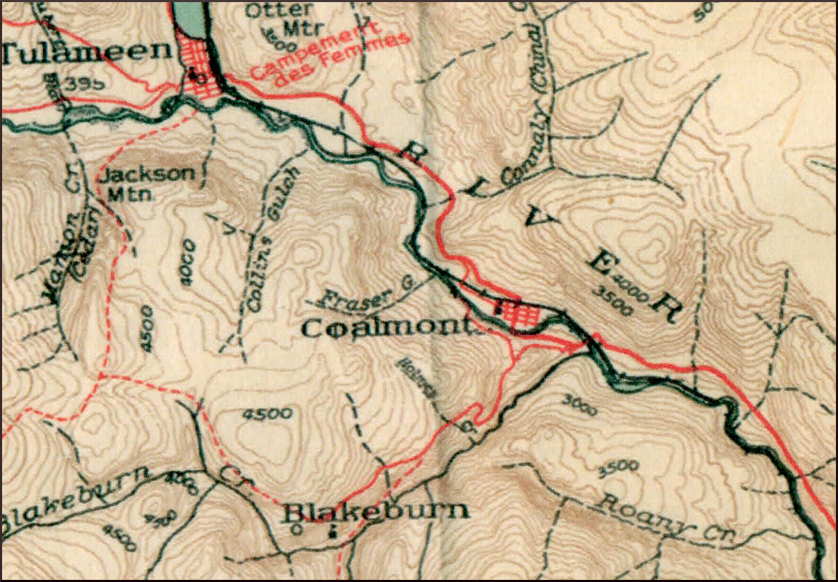
Detail - from before Coalmont Road was completed on north side of Tulameen.
Coalmont, Blakeburn, Tulameen - Department of National Defence Map - 1939
[42]
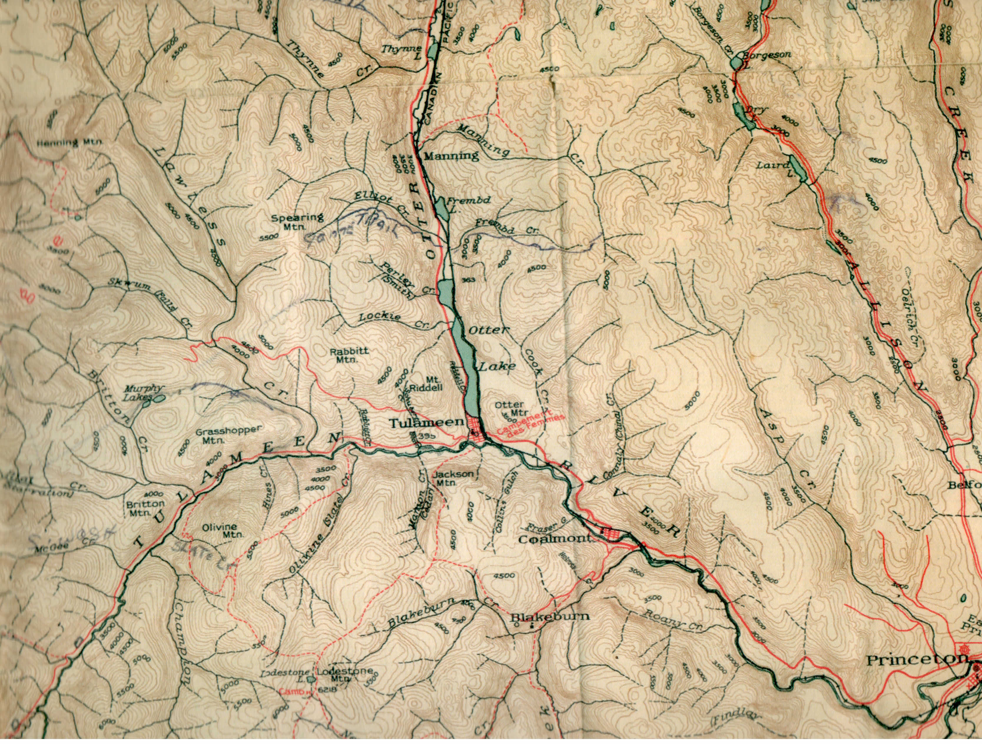
Coalmont to Tulameen area section of 1939 Department of National Defence Map.
Princeton, Blakeburn, Coalmont, Tulameen - Department of National Defence Map
[42]
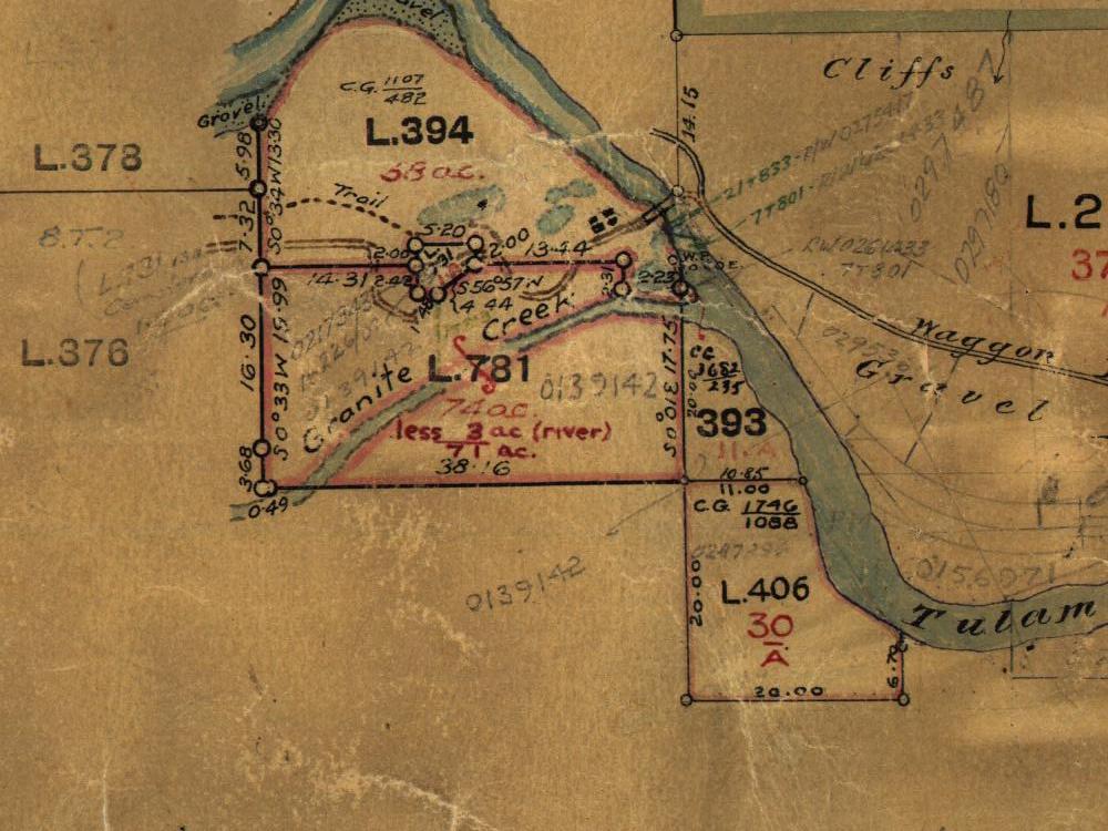
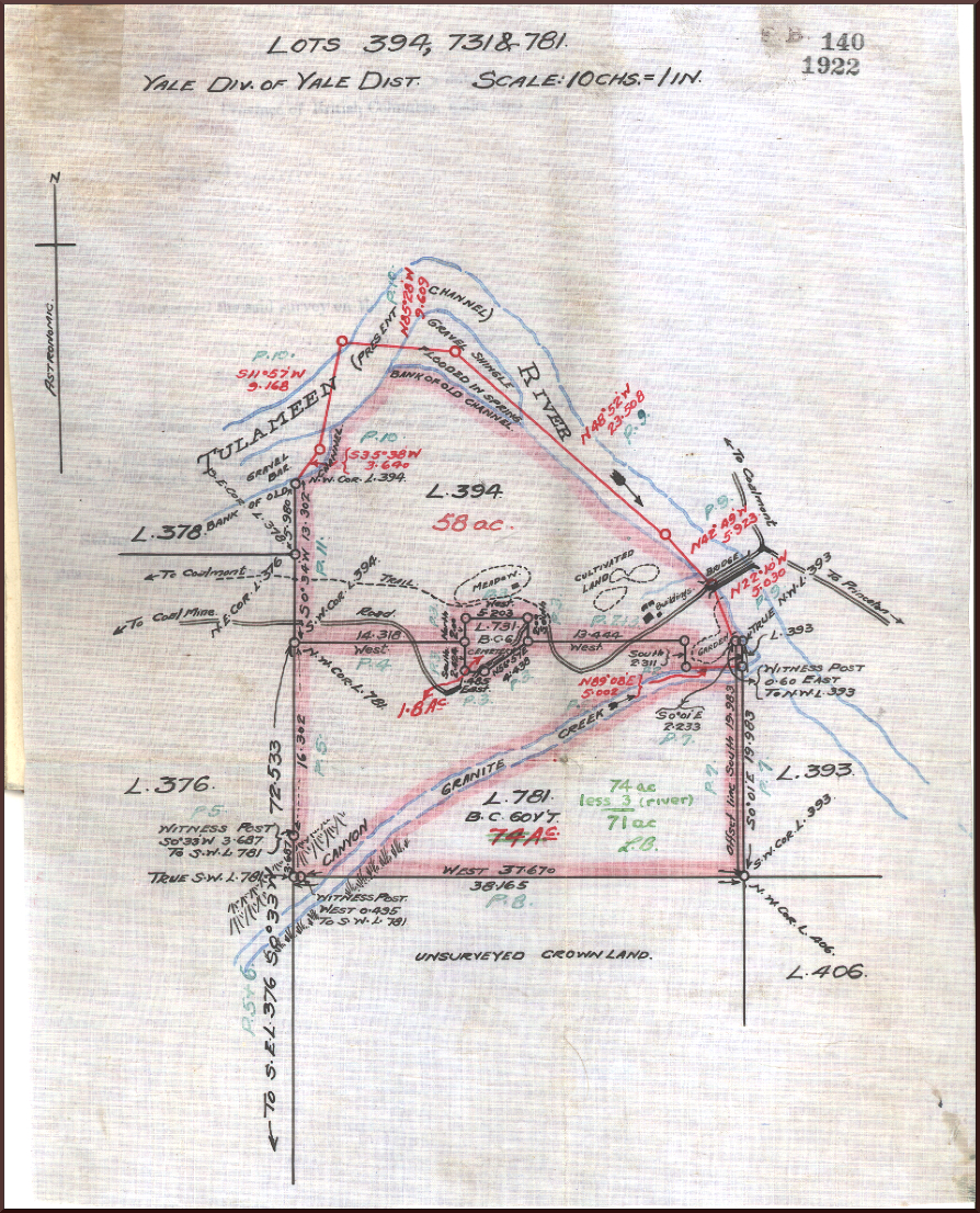
1922 - before Rice Road was added.
Survey map of Granite Creek Lots 394, 731 and 781 - 1922
[43]
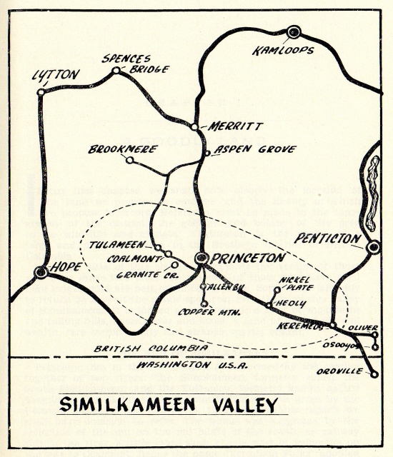
Map from "The Story of the Similkameen" - J. Goodfellow.
Map of Similkameen according to Goodfellow
If you have an interest in the history of the Tulameen valley, mining district,
and Granite Creek
please become a member of the society.